A Stake-Out Survey, also called a Construction Survey or Setting-Out Survey, is a process in which surveyors transfer planned designs from drawings or digital models onto the actual ground. It involves marking the exact location of buildings, roads, utilities, and other structures before construction begins. This ensures that what is built on site aligns perfectly with the approved design plans.
At MLL III Land Surveying and Mapping Services, we conduct stake-out surveys with precision and compliance. Our licensed geodetic engineers provide the reference points that contractors and developers need to execute projects accurately, avoiding costly errors and ensuring construction quality.
Services
Stake-out surveys are essential for nearly every construction project, big or small. Common scenarios include:
Building Construction: Ensures that houses, offices, and commercial structures are built in the correct location and orientation.
Road and Highway Projects: Marks alignments, widths, and elevation points to guide earthworks and paving.
Subdivision Developments: Defines lot boundaries, road layouts, and utility lines before site work begins.
Utility Installations: Provides exact markers for pipelines, electrical lines, and drainage systems.
Industrial Projects: Guides contractors when building factories, warehouses, and large-scale facilities.
Without a stake-out survey, projects risk misaligned buildings, boundary violations, and costly reconstruction.
Services
At MLL III, we follow a proven process that ensures accuracy and compliance:
Project Consultation – We review design drawings, engineering plans, and permits with the client.
Preparation of Control Points – Existing survey benchmarks are verified or new control points are established on site.
Data Analysis – Using Civil 3D, AutoCAD, and GIS software, we convert design plans into survey coordinates.
On-Site Stake-Out – Our team uses GNSS, total stations, and measuring equipment to transfer design points to the ground. Stakes, flags, or markers are placed to indicate exact construction positions.
Verification and Adjustment – The staked points are checked against the design to ensure compliance.
Documentation – A stake-out survey report is prepared, including diagrams and technical descriptions for contractors to follow.
Services
Our stake-out surveys comply with the Geodetic Engineering Act of 1998 (RA 8560) and follow technical standards required by DPWH, LGUs, HLURB/DHSUD, and DENR. All surveys are supervised and certified by licensed geodetic engineers registered under the Professional Regulation Commission (PRC). This ensures that results are legally valid and reliable for permitting, construction, and inspection.
At MLL III, we invest in modern tools to deliver precise stake-out surveys, including:
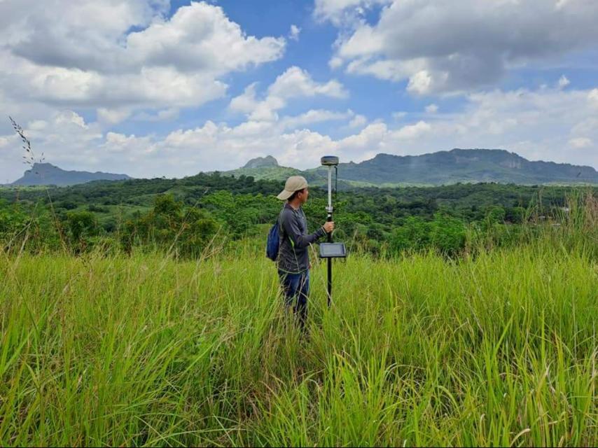
GNSS (Global Navigation Satellite Systems) for accurate georeferencing
Total Stations for high-precision distance and angle measurements
AutoCAD Civil 3D and GIS software for data conversion and plotting
Laser equipment and advanced survey markers for on-site accuracy
This combination of technology and expertise allows us to deliver fast and reliable results that integrate seamlessly into construction workflows.
Get in touch with us for accurate and reliable surveying and mapping services in the Philippines. Contact us for a consultation and let us guide your project with precision and expertise.
This website uses cookies to provide you with the best browsing experience.