GIS Mapping and Analysis

Introduction

GIS Mapping and Analysis is one of the most powerful tools in modern land surveying and geospatial services. GIS, or Geographic Information Systems, is a technology that integrates spatial data (maps, coordinates, terrain features) with attribute data (land use, ownership, demographics, and environmental information). By combining these datasets, GIS provides detailed insights that help planners, developers, government agencies, and private landowners make informed decisions.

At MLL III Land Surveying and Mapping Services, we deliver GIS-based solutions tailored to land development, infrastructure projects, environmental management, and resource planning. Our GIS mapping services allow clients to visualize spatial relationships, analyze trends, and optimize land use with precision.

Services

Why GIS Mapping and Analysis Is Needed

GIS is applied in a wide range of industries and sectors. Common applications include:

  • Urban and Regional Planning: Helps LGUs and developers assess zoning, land use, and urban growth.

  • Infrastructure Development: Supports project planning by integrating maps with utility networks, roads, and transportation systems.

  • Environmental Management: Monitors deforestation, flooding, coastal erosion, and natural resources.

  • Agriculture: Assists in crop monitoring, irrigation planning, and land suitability analysis.

  • Disaster Management: Provides hazard maps and vulnerability assessments for typhoon, earthquake, and flood preparedness.

  • Real Estate and Land Development: Helps identify prime locations, evaluate land values, and plan subdivisions.

Without GIS, decision-makers rely only on static maps and limited data, which can lead to inefficiencies and poor planning outcomes.

Services

The Process of GIS Mapping and Analysis

At MLL III, we combine surveying expertise with GIS technology through the following process:

  1. Project Consultation – Define the client’s objectives, whether for development, environmental, or research purposes.

  2. Data Collection – Gather spatial data using GNSS, total stations, UAVs, hydrographic surveys, and existing records.

  3. Data Integration – Combine spatial data with attribute data, such as land use, ownership, population, or environmental factors.

  4. GIS Database Creation – Build a structured database that allows interactive mapping and querying.

  5. Analysis and Modeling – Perform spatial analysis to identify trends, patterns, and risks.

  6. Map Production and Visualization – Generate thematic maps, orthophotos, and reports for decision-making.

  7. Final Deliverables – Provide clients with digital GIS data, interactive maps, and analysis reports.

Services

Benefits of GIS Mapping and Analysis

  • For LGUs and Government Agencies: Improves planning, zoning, and disaster risk reduction.

  • For Developers: Provides data-driven insights for site selection and land use optimization.

  • For Engineers: Integrates survey data with design software for accurate planning.

  • For Environmental Managers: Tracks ecological changes and supports sustainable land management.

  • For Landowners: Offers clear visualizations of property features, boundaries, and potential.

Compliance and Accuracy

Our GIS services comply with the Geodetic Engineering Act of 1998 (RA 8560) and align with standards from DENR, NAMRIA, DPWH, and HLURB/DHSUD. All outputs are certified by licensed geodetic engineers, ensuring data reliability, legal recognition, and government acceptability.

Technology in Use

At MLL III, we use industry-standard tools and platforms for GIS analysis, including:

  • ArcGIS and QGIS for data management and analysis

  • AutoCAD Civil 3D for design integration

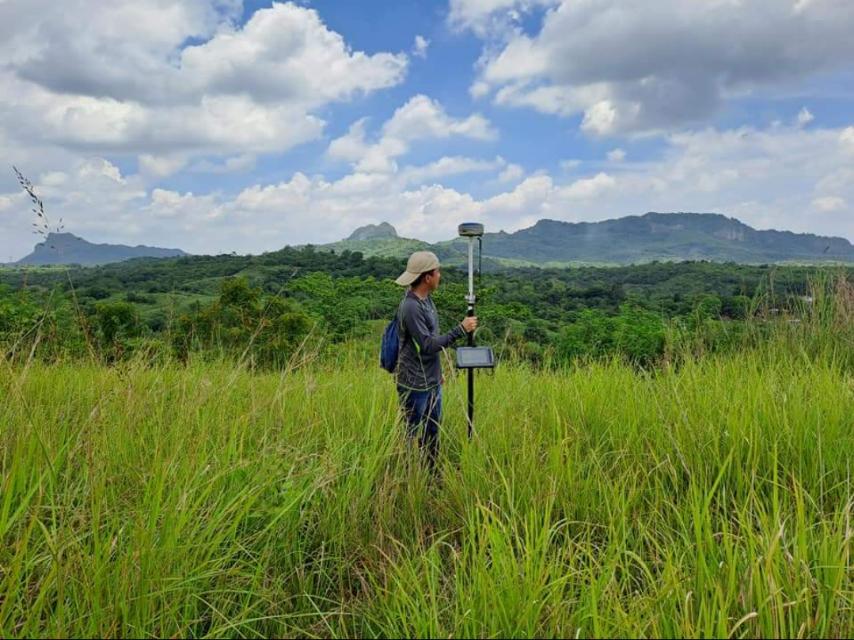
  • GNSS and UAVs for spatial data collection

  • Remote sensing and satellite imagery for large-scale mapping

  • GIS databases for interactive and long-term data management

This technology enables us to provide high-accuracy maps, advanced analytics, and future-ready geospatial solutions.

Real-World Applications

  • Subdivision and Land Development: GIS helps identify the best lot layouts, drainage systems, and road networks.

  • Transportation Planning: GIS supports traffic studies, road alignments, and public transport development.

  • Coastal and Marine Management: Used for shoreline monitoring, erosion control, and marine conservation.

  • Agricultural Land Use: Helps determine soil suitability, water availability, and crop yield optimization.

  • Disaster Risk Reduction: Provides hazard maps for flooding, landslides, and earthquakes to guide emergency planning.

  • Utility Mapping: Records and analyzes the placement of water lines, power cables, and telecommunications systems.

Start Your Project with Confidence Today!

Get in touch with us for accurate and reliable surveying and mapping services in the Philippines. Contact us for a consultation and let us guide your project with precision and expertise.

This website uses cookies to provide you with the best browsing experience.

Accept
Decline