A Topographic Survey is one of the most widely used surveying methods in the Philippines. It involves measuring and mapping the elevations, contours, and physical features of a parcel of land to create a detailed representation of its surface. Unlike a simple boundary survey that only defines property limits, a topographic survey captures the shape of the land, including slopes, depressions, trees, buildings, roads, drainage lines, and other natural or man-made features.
At MLL III Land Surveying and Mapping Services, we provide topographic surveys that are precise, reliable, and tailored to the needs of property owners, developers, engineers, and government agencies. Our surveys are essential for project planning, site grading, drainage design, and construction, ensuring that every structure is built on accurate ground data.
Services
Topographic surveys are critical in many scenarios, such as:
Construction Projects: Before starting site development or building construction, engineers need elevation data to plan grading, foundation levels, and drainage systems.
Architectural Design: Architects rely on topographic maps to design structures that fit naturally with the landscape.
Subdivision Development: Developers use topographic data to plan road networks, drainage layouts, and residential or commercial lots.
Environmental Planning: Government agencies and consultants use topographic surveys to assess flood-prone areas, erosion risks, and water flow.
Land Titling and Permitting: Some applications for land use and construction permits require a certified topographic survey.
For example, a subdivision project in Bulacan would require a detailed topographic survey to design its roads, drainage, and house lots. Without it, the project risks flooding, uneven foundations, and costly reworks.
Services
At MLL III, we follow a systematic process to ensure accuracy and compliance:
Initial Consultation – We meet with clients to define the project scope and requirements.
Research and Planning – We review existing survey data, maps, and government records for accuracy.
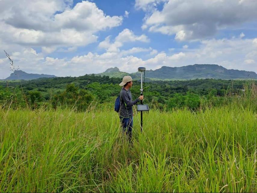
Field Data Collection – Using GNSS, total stations, and drones (UAVs), we measure elevations, slopes, and land features across the property.
Data Processing – Elevation points and contours are plotted using AutoCAD Civil 3D and GIS platforms.
Validation and Review – All survey data is cross-checked against benchmarks and previous records to confirm accuracy.
Final Output – We deliver certified topographic maps, contour plans, and digital files (PDF/DWG) that are legally compliant and ready for use in engineering and design.
Services
Our surveys are conducted in accordance with the Geodetic Engineering Act of 1998 (RA 8560) and other regulatory requirements by DPWH, DENR, HLURB, and LGUs. Each topographic survey is supervised and certified by a licensed geodetic engineer registered under the Professional Regulation Commission (PRC). This guarantees that results are legally admissible and valid for permitting and design approvals.
To deliver high-quality results, MLL III uses modern equipment and software, including:
GNSS (Global Navigation Satellite Systems) for precise georeferencing
Total Stations for distance and angle measurements
Drones/UAVs for aerial mapping and orthophoto generation
AutoCAD Civil 3D, GIS platforms, and other geospatial tools for advanced processing
These technologies allow us to provide surveys that are not only accurate but also delivered faster, giving clients the data they need to move projects forward without delay.
Residential Developments: Used to design house lots, drainage, and access roads.
Infrastructure Projects: Roads, bridges, and utilities require topographic data before planning and construction.
Flood Control and Drainage Systems: Elevation data supports hydraulic design and flood mitigation strategies.
Commercial and Industrial Projects: Factories, malls, and business parks need accurate terrain data for site planning.
Environmental Studies: Topographic surveys help identify flood-prone zones, landslide risks, and erosion areas.
Get in touch with us for accurate and reliable surveying and mapping services in the Philippines. Contact us for a consultation and let us guide your project with precision and expertise.
This website uses cookies to provide you with the best browsing experience.