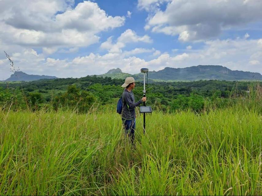
A Hydrographic Survey is a specialized surveying method that focuses on measuring and mapping bodies of water, including rivers, lakes, reservoirs, harbors, and coastal areas. It involves collecting data about water depth, seabed features, tides, currents, and underwater obstructions. This type of survey is essential for navigation, engineering, coastal development, and environmental monitoring.
At MLL III Land Surveying and Mapping Services, we provide hydrographic surveys that meet the needs of engineers, developers, shipping operators, and government agencies in the Philippines. Using modern instruments and methodologies, we deliver reliable data that supports safe navigation, flood control, and marine development projects.
Services
Hydrographic surveys serve a wide range of purposes. They are commonly required for:
Port and Harbor Development: Ensures safe navigation by identifying water depths and potential obstructions.
Bridge and Wharf Construction: Provides underwater profiles needed for foundation and piling design.
Flood Control Projects: Supplies data on riverbeds and waterways for drainage and flood mitigation systems.
Irrigation and Water Resource Management: Determines reservoir capacity, water levels, and flow patterns.
Environmental Studies: Documents coastal erosion, sedimentation, and marine ecosystems.
Navigation Safety: Identifies hazards for boats, ships, and ferries, improving maritime safety.
Without hydrographic surveys, marine and riverine projects face higher risks of structural failure, flooding, or navigational accidents.
Services
At MLL III, we apply internationally recognized methods to ensure accurate results:
Project Assessment – We define survey objectives, whether for navigation, engineering, or environmental monitoring.
Data Collection Preparation – Instruments such as echo sounders, GPS/GNSS units, and current meters are calibrated.
Field Data Collection – Using boats and floating platforms, we collect depth measurements, current flows, and sediment data.
Tidal Observations – Water levels and tidal patterns are monitored to adjust depth readings for accuracy.
Seabed Profiling – Data is processed to show underwater topography, sediment layers, and obstructions.
Data Processing – Software such as Civil 3D, GIS, and hydrographic modeling tools are used to create detailed bathymetric maps.
Final Outputs – Clients receive certified hydrographic charts, profiles, and digital files ready for engineering and regulatory submission.
Services
For Engineers: Provides underwater profiles for safe and cost-effective designs.
For Developers: Supports coastal reclamation, ports, and waterfront projects.
For Government Agencies: Aids in flood control, disaster prevention, and maritime safety.
For Environmental Planners: Supplies data for shoreline management and ecological preservation.
For Shipping Operators: Ensures safe navigation routes free from obstructions.
Our hydrographic surveys comply with the Geodetic Engineering Act of 1998 (RA 8560) and technical standards from the DENR, DPWH, and MARINA. All surveys are supervised by PRC-licensed geodetic engineers, ensuring accuracy and legal admissibility. For projects involving navigation, results can also be aligned with International Hydrographic Organization (IHO) standards.
At MLL III, we use advanced equipment and tools to deliver reliable hydrographic survey results:
Single-beam and multi-beam echo sounders for depth measurement
GNSS positioning systems for georeferencing underwater features
Current meters and tide gauges for water flow and tidal monitoring
GIS and Civil 3D platforms for processing bathymetric and hydrographic data
These tools allow us to provide accurate, high-resolution maps of underwater conditions.
Port Development: Hydrographic surveys ensure safe ship docking, channel dredging, and port expansion.
Bridge and Wharf Foundations: Provides underwater profiles for stable and secure foundation design.
Flood Control Projects: Helps engineers design dikes, floodways, and drainage systems.
Coastal Management: Supports reclamation, shoreline protection, and erosion studies.
Fisheries and Marine Resources: Assists in sustainable resource management and environmental studies.
Disaster Mitigation: Provides crucial data for flood and storm surge modeling.
Get in touch with us for accurate and reliable surveying and mapping services in the Philippines. Contact us for a consultation and let us guide your project with precision and expertise.
This website uses cookies to provide you with the best browsing experience.