Drone Surveying and Orthophotos have revolutionized the field of land surveying and mapping in the Philippines. By using unmanned aerial vehicles (UAVs), surveyors can quickly capture high-resolution aerial images and transform them into orthophotos (geometrically corrected aerial images) that provide precise, scaled representations of the Earth’s surface. Unlike traditional aerial photographs, orthophotos are corrected for distortion, allowing accurate measurements of distance, area, and elevation.
At MLL III Land Surveying and Mapping Services, we harness drone technology to provide cost-effective, detailed, and accurate geospatial data. Drone surveying allows us to cover large areas in less time while producing outputs that integrate seamlessly with GIS, CAD, and BIM systems for planning, design, and development.
Services
Drone surveying is widely used across industries because of its efficiency and accuracy. Common applications include:
Land Development and Real Estate: Developers use orthophotos to visualize property layouts, assess terrain, and prepare subdivision plans.
Infrastructure Projects: Engineers and planners rely on drone surveys for road, bridge, and utility corridor design.
Agriculture: Large-scale farms use aerial mapping to monitor crops, irrigation, and land conditions.
Environmental Monitoring: Drones document erosion, flooding, deforestation, and other environmental impacts.
Mining and Quarrying: Orthophotos help calculate stockpile volumes, monitor extraction, and ensure safety compliance.
Disaster Management: Government agencies use drone surveys to assess damage after typhoons, floods, and earthquakes.
Without drone surveys, these projects would require longer timelines, higher costs, and less detailed outputs compared to UAV-enabled methods.
Services
At MLL III, our process combines field expertise with advanced drone technology:
Project Planning – We assess the survey area, define objectives, and secure necessary permits for UAV flights.
Flight Preparation – Drones are programmed with automated flight paths to ensure complete coverage and accuracy.
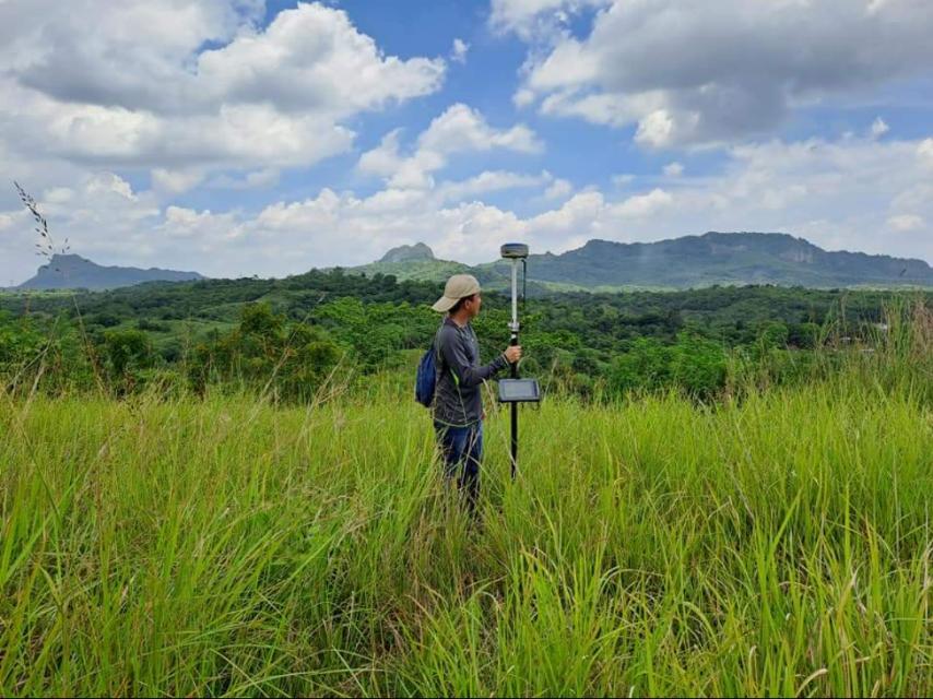
Aerial Data Capture – UAVs capture overlapping high-resolution images of the site, often supplemented with GPS/GNSS positioning.
Image Processing – Captured images are processed using specialized software to create orthophotos, digital surface models (DSM), and digital terrain models (DTM).
Georeferencing and Correction – Images are corrected for tilt, distortion, and elevation to align with actual ground coordinates.
Data Integration – Orthophotos and models are integrated with CAD, GIS, and engineering software for analysis and design.
Deliverables – Clients receive certified orthophotos, 3D terrain models, and geospatial data ready for project use.
Services
For Developers: Provides a bird’s-eye view of land parcels for planning and marketing.
For Engineers: Delivers detailed terrain models that enhance design accuracy.
For Government Agencies: Assists in disaster response, zoning, and environmental management.
For Contractors: Allows real-time monitoring of project progress.
For Landowners: Provides a clear, visual record of property features and boundaries.
Drone surveying at MLL III complies with the Civil Aviation Authority of the Philippines (CAAP) regulations and the Geodetic Engineering Act of 1998 (RA 8560). All outputs are validated and certified by PRC-licensed geodetic engineers, ensuring that results are not only accurate but also legally admissible and compliant with government requirements.
We use state-of-the-art UAVs and processing tools to deliver high-quality orthophotos and survey data:
UAVs/Drones equipped with GPS/GNSS for aerial imaging
Photogrammetry software for orthophoto generation and terrain modeling
Civil 3D, AutoCAD, and GIS platforms for integration with engineering and mapping projects
3D modeling tools for visualization and volume analysis
This advanced technology enables us to provide fast, cost-efficient, and highly detailed outputs that traditional surveys cannot match.
Subdivision Mapping: Orthophotos provide developers with accurate visual references for designing road networks and lot layouts.
Road and Highway Projects: Drone surveys cover long corridors quickly, providing terrain data for alignments.
Agricultural Land Management: Orthophotos help farmers monitor crops and optimize irrigation.
Mining Operations: UAVs map stockpiles, measure excavation volumes, and enhance site safety.
Disaster Assessment: Drones provide rapid aerial imagery for relief planning and rehabilitation.
Coastal Mapping: UAVs document shoreline changes and erosion for coastal development planning.
Get in touch with us for accurate and reliable surveying and mapping services in the Philippines. Contact us for a consultation and let us guide your project with precision and expertise.
This website uses cookies to provide you with the best browsing experience.